
Geotag: Geolocation GPS Stamp
by AM Infotech
GPS Geotag: Add geolocation stamps to photos, track locations on a map.
| App Name | Geotag: Geolocation GPS Stamp |
|---|---|
| Developer | AM Infotech |
| Category | Photography |
| Download Size | 18 MB |
| Latest Version | 1.8 |
| Average Rating | 0.00 |
| Rating Count | 0 |
| Google Play | Download |
| AppBrain | Download Geotag: Geolocation GPS Stamp Android app |


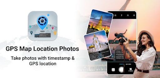
Capture your adventures with precision using Geotag: Geolocation GPS Stamp, the best app for adding GPS coordinates and geolocation stamps to your photos. Whether you're a traveler, hiker, or photography enthusiast, this app helps you document your journeys with accurate location data, track your movements on a live map, and save your favorite spots effortlessly.
Why Use Geotag: Geolocation GPS Stamp?
• Accurate Geotagging: Automatically add GPS coordinates to your photos for precise location tracking.
• Live Map Integration: View your current location on a detailed map and track your route in real-time.
• Customizable Stamps: Personalize your photos with geolocation stamps that include date, time, and GPS coordinates.
• Save & Share: Save your geotagged photos with location data and share them with friends or on social media.
Perfect for Every Adventure
• Travelers: Document your trips with precise geolocation data and create unforgettable memories.
• Hikers: Track your hiking routes, save your favorite trails, and explore new paths with GPS coordinates.
• Photographers: Add professional geotags to your photos and organize them by location for easy access.
• Outdoor Enthusiasts: Whether you're camping, biking, or exploring, this app ensures you never lose track of your location.
How It Works
→ Enable GPS Tracking: Open the app and allow GPS tracking to start recording your location.
→ Take or Upload Photos: Capture new photos or upload existing ones from your gallery.
→ Add Geolocation Stamps: Customize your photos with geolocation stamps that include GPS coordinates, date, and time.
→ View on Map: See your location on a live map and track your movements in real-time.
→ Save & Share: Save your geotagged photos with location data and share them with friends or on social media.
Key Benefits of Using Geotag: Geolocation GPS Stamp
→ Enhanced Photo Organization: Easily organize your photos by location using GPS coordinates.
→ Professional Geotagging: Add geolocation stamps to your photos for a professional touch.
→ User-Friendly Interface: Enjoy a simple and intuitive design that makes geotagging and GPS tracking easy for everyone.
Download Geotag: Geolocation GPS Stamp Today!
Transform your photos with accurate geolocation data and explore the world like never before. Whether you're traveling, hiking, or capturing memories, Geotag: Geolocation GPS Stamp is your go-to app for GPS photo tagging, location tracking, and map integration. Download now and start documenting your adventures with precision!